- Home page
- What were you doing out there on Highway 61?
- Why did you dig there?
- Where is the site?
- Who lived there?
- What happens after the digging?
- What is archaeology?
- What is it like to work on a field crew?
- What is it like to work in the lab?
- Are there laws that protect archaeological sites?
- Ask a Native American about tribal history, archaeology, and more
- Who can I contact for more information?
- Special pages for students
- Special pages for teachers
- Special pages for archaeologists
Answering your questions
‘Where is the site?’
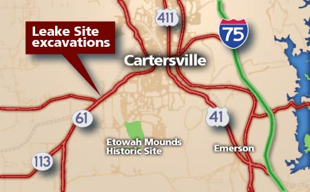
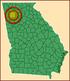
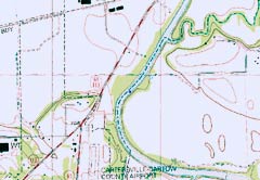
The Leake Site is located in Cartersville, Georgia, less than an hour northwest of Atlanta. Like many important Native American sites, it is situated along a major river, in this case, the Etowah. The Leake Site is in a bend of the Etowah River historically known as Roland’s Bend, west of downtown Cartersville and two miles down the Etowah from the famous Etowah Mounds National Historic Landmark. Traveling west out of Cartersville on State Highways 61 and 113, you cross the Etowah River. The site is located on both sides of the road after crossing the river, for at least one-half mile all the way to Riverside Drive, but likely even further. For centuries Indians, Africans, and Europeans farmed the fertile floodplain soils of Roland’s Bend. Today much of the area is characterized by industrial development, and unfortunately the undeveloped area of the Leake site is growing smaller.

One of the central questions we are addressing in our research concerns why the Indians selected this spot. The answers are sure to be varied, but the geography, geology and proximity to travel paths must have played a role. The Leake site and Roland’s Bend are uniquely situated at a spot where the Etowah River exits the Piedmont and enters the Great Valley. Native Americans used the different soils, plants, and other natural resources, including rocks and minerals characterizing these two physiographic zones. Living close to both zones enabled the Indians to have easy access to these varied resources. Another likely reason why the Leake Site developed here is that it is located on a major corridor running from the Gulf of Mexico to the Ohio River Valley. During the Middle Woodland Period (300 BC to AD 650), this corridor saw the movement of goods and the exchange of new ideas across much of the eastern part of the continent. Today, Cartersville, Georgia still benefits from its location on a major trade corridor (Interstate Highway 75) for goods and ideas.


