Content for our fellow researchers
‘A Project Summary for the Leake Site’
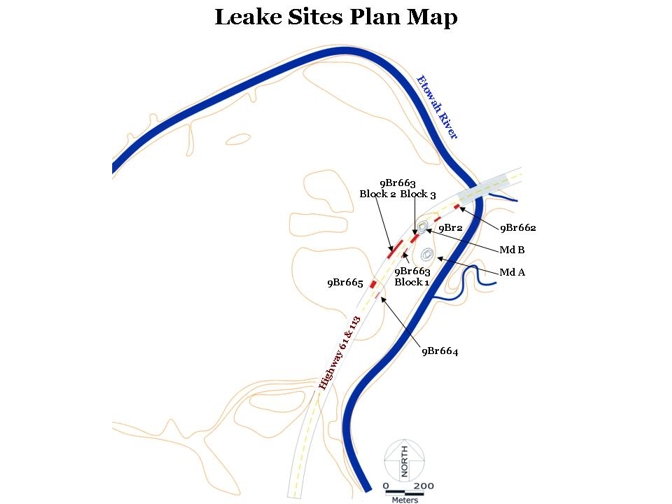
As pictured in the map below by the linear red blocks, excavation areas at the Leake site were located within the right-of-way corridor required for the widening of Highways 61/113. Originally recorded as state site 9BR2, the Leake site is made up of several state sites, including 9BR662, 663, 664, 665, 666, 667, and 668. Southern Research employed both mechanical and hand excavation techniques to excavate approximately 4,500 square meters of the Leake site. Most of the hand excavation at the site (apart from feature excavation) was conducted within Block 2, where intact midden remaining from the intensive Swift Creek occupation was located. We excavated 83 2 x 2 m test units in the midden area, and 72 of the units are contiguous. We recorded over 2,600 features during the project, including hearths, feasting pits, posts, rock clusters, and storage pits.
Data from the Leake sites reveals that the most significant components within the corridor to be impacted by the proposed road widening remain from the Middle Woodland Cartersville and Swift Creek occupations. Based on testing data from Leake, Pluckhahn (1998:329-30) tentatively identified temporal/cultural phases for the Middle Woodland period in this area of the Etowah River Valley. Data from the current investigation should allow us to refine the characteristics for each phase, and also to define phases for the post-400 A.D. Swift Creek occupation(s). The Cartersville phase extends from approximately 300 B.C. until 200 A.D., and is marked by the predominance of check stamped pottery; simple stamped and fabric impressed wares are present at minority frequencies. By approximately 100 A.D.,
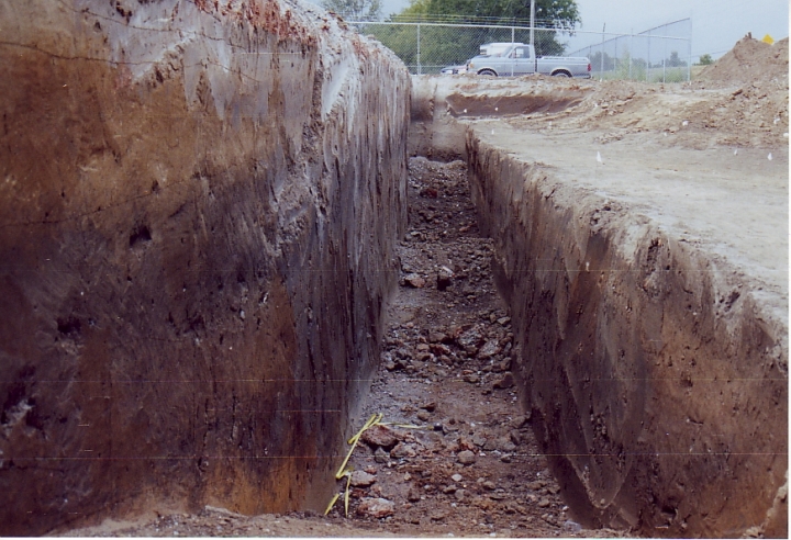
Further, the excavations and research revealed the presence of a massive semi-circular ditch earthwork (see photo below). This massive ditch feature appears to have been constructed during the Middle Woodland occupation, possibly in order to enclose Mounds A and B on an island formed by it and the Etowah River.
If you have a question or comment, please email one of our Principal Investigators, Scot Keith.